Recently, the Office of the Leading Group for the First National Surveyon Comprehensive Natural Disaster Risks of the State Council and the Ministry of Emergency Management issued the Decision to Commend the Outstanding Groups and Individuals in the First National Survey on Comprehensive Natural Disaster Risks.”Xinjiang University Key Laboratory of Xinjiang Oasis Ecology at the Provincial Level Wins the Title of“Outstanding Group in the First National Survey on Comprehensive Natural Disaster Risks”.
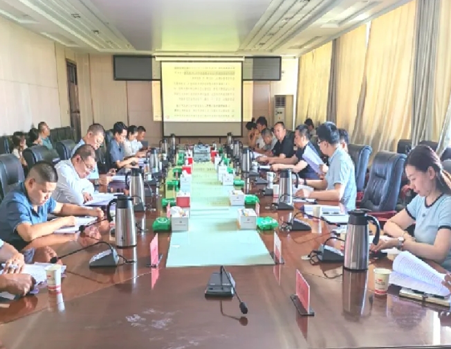
Symposium on the Pilot Work of the General Survey Results
The National Survey on Comprehensive Natural Disaster Risks is a significant investigation on national conditions and strength, and serves as a fundamental task in enhancing the capability to prevent or mitigate natural disasters.By conducting this survey, we can identify the underlying risks and latent dangers of natural disasters nationwide, ascertain the disaster resistance capabilities of key regions, and gain an understanding of the comprehensive risk levels of natural disasters across the country and in various areas.This will provide authoritative information on disaster risks and a scientific basis for decision-making, enabling central and local governments at all levels to effectively carry out disaster prevention and mitigation, thereby ensuring the sustainable development of the economy and society.
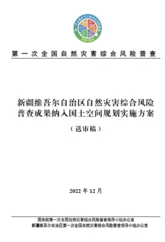
the Cover Page of the Survey Results
Since the launch of the survey,the Key Laboratory of Xinjiang Oasis Ecology has actively cooperated with the Office of the Leading Group for the First National Survey on Comprehensive Natural Disaster Risks in Xinjiang Uygur Autonomous Region. Adhering to the principles of being scientific, standardized, effective, and operable, the laboratory has diligently carried out four key tasks, namely,Incorporating the Survey Results into the Comprehensive Analysis of Territorial Spatial Planning,the Manual for Comprehensive Prevention and Mitigation of Natural Disasters, Standardized Mapping of Assessment and Zoning Geographical Base Maps, and Comprehensive Risk Prevention and Control Zoning for Disasters in Wensu County.These efforts have led to high-quality and efficient progress in the application of the survey results. Significant breakthroughs have been achieved inthe linkage and application of the survey results and territorial spatial planning data inkey technologies and in the innovation of attribute semantic relevance theory. This provides technological supports for disaster prevention standards setting in the region and the establishment of a red-line constraint mechanism for natural disasters,embodying an ideal application of the science of disaster prevention and mitigation to the vast land of China’s northwest.(Source:College of Geography and Remote Sensing Sciences, Office of Science and Technology)